The Beta
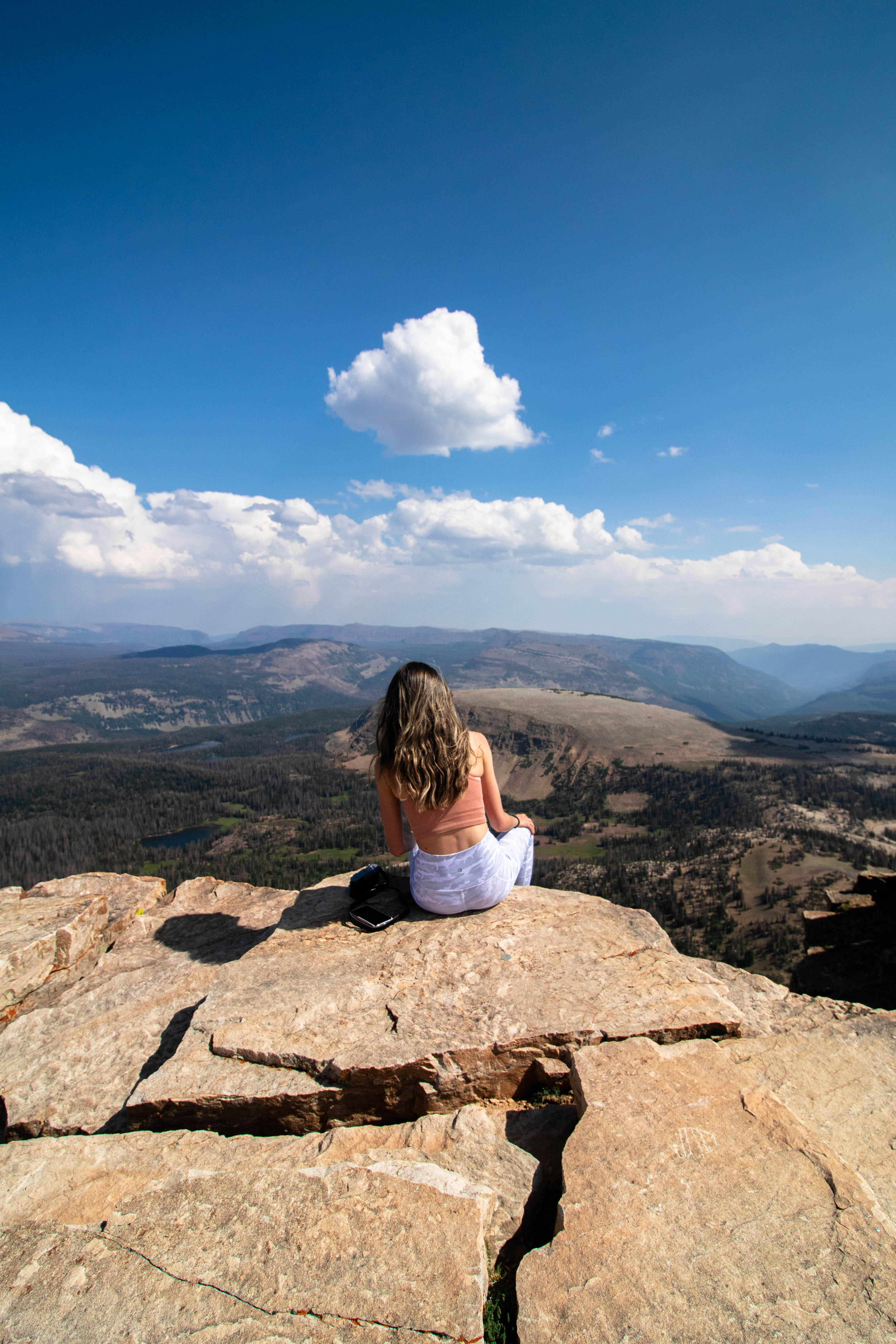
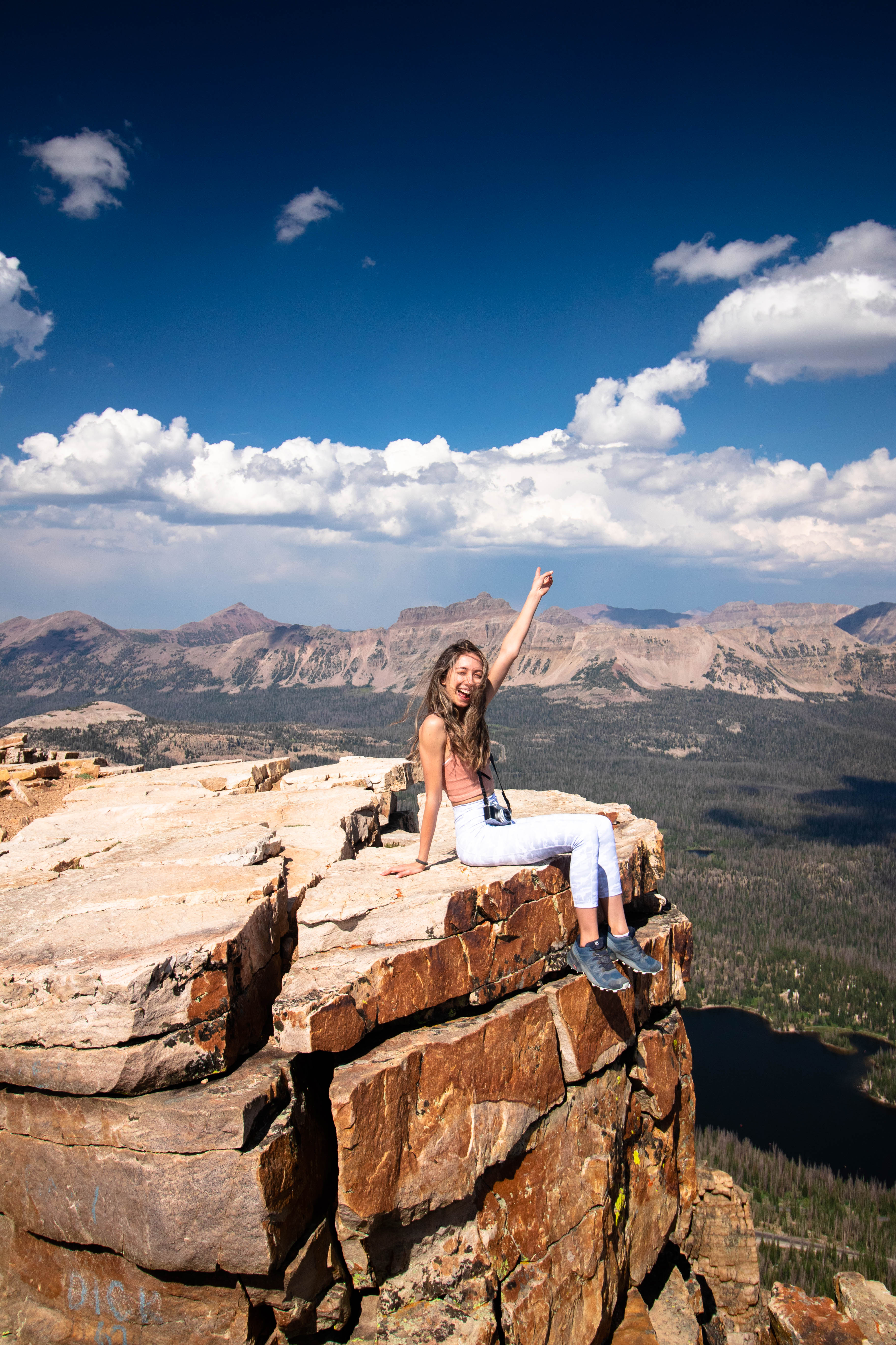
Bald Mountain is one of the easiest mountains to summit in the Uintas, and has some pretty spectacular views! It’s a 3.2 mile out-and-back trail that features spectacular panoramic views of the Uinta Mountain Range, Hayden Peak, and a variety of lakes including Mirror Lake and Hoover Lake. This trail is rated as difficult, due to a starting elevation of 10,700+ feet in elevation, but coming down is a breeze. Once you’re completed, you’ll be standing at an elevation of 11,947 feet!
The hike
The hike starts out from the Bald Mountain trailhead, which has it’s own sign on Highway 12 at the Bald Mountain Pass. Start out at the trailhead, taking the trail on the right to begin up Bald Mountain. This trail slowly snakes it’s way up the steep mountain, and you’ll gain most of your elevation in the first quarter mile of the trail. You’ll eventually break through tree line at around the half mile mark, and a slow, gently incline progresses up the mountain. The trail can be difficult to follow at time, so be sure to keep your head up!
You’ll reach a “false summit” of sorts, so continue on another 500 feet or so to the real summit. There are no trail markers to signal the end of the hike, or the highest point of the mountain, but it’s pretty clear that the trail ends in a large boulder field.


Need to Know
Parking at the trailhead is limited on weekends, and is often full, due to there being multiple hiking options from this trailhead. There is a fee to pay if you haven’t already: $6 per vehicle for 1 to 3 days in the Uintas, or a National Parks Pass. Display one or the other on your windshield before you begin your hike!
Thunderstorms frequent the Uintas in the afternoon, even if it is not in the forecast. Be sure to check the weather before your hike, and during your hike if weather is ominous. They come out of nowhere, and can last anywhere from a few minutes to hours. Be prepared – there is no cover from the storm after you break tree line, and high elevation is not a good place to be during a violent thunderstorm.

Justin’s Suggestion
Watch the weather and try to do this hike in the early morning. You’ll have the best luck at finding a parking spot, and the best weather for your hike. During weekdays in the summer, trailhead parking is light, and so are the trails; weekends are busier for obvious reasons. Pick a day clear of clouds and smoke to see the furthest, as there are really some fabulous views here.
Bring water, sunscreen, a hat, sunglasses, and snacks. This trail is short but taxing! Cameras are also great to have. Come prepared for a variety of elements, and expect wind at times during your ascent and descent.

Take A Hike!
This is a fantastic hike and you’ll have a great time with one of the best views of the Uinta Range! Head down this mountain and try hiking to Notch Lake and Bench Lake. This is a great little day hike, and can also be used as an introduction to backpacking for beginners.
A shorter day hike is Hoover Lake, which is 4.0 miles roundtrip!
And, make sure you check out Mirror Lake for paddle boarding, kayaking, and fishing! You can find all of my blogs about the High Uintas right here.
See you on the trail – enjoy the views!
Parting shot:

Next blog: More lakes. More hikes. It doesn’t stop!


Only 3.2 miles?? That is so quick!! Usually summit trails are way longer than this. I bet it’s pretty popular then because of this! These are gorgeous photos, seems like you two had a good time and perfect weather!
LikeLiked by 1 person
Yep. give or take! It’s actually really short, I was surprised by it myself! The weather could not have been better, either!
LikeLike
Those views are so STUNNING! Such a clear day up there! Was it pretty hot on the trail in the middle of summer?
LikeLiked by 1 person
It was so stunning! Surprisingly, not that hot! We had some pretty good wind, though, so that cooled the air a little bit. Being at elevation helps!
LikeLike
We love bald mountain!! The views are amazing!! These pictures are great you can see what a great time you’re having and the backdrop is magical!
LikeLiked by 1 person
Bald Mountain is pretty fantastic! I was a little underwhelmed at first since it’s such a short hike (I like to work for my hikes, I guess), but the views are totally worth it!
LikeLiked by 1 person
Beautiful pictures. Talk about a hike with a view!
LikeLiked by 1 person
Right!? It’s such an easy way to get to just under 12,000 feet!
LikeLiked by 1 person
What a hike! And those views for less than a 4 mile trail. Amazing!
LikeLiked by 1 person
It’s a good one! If you’ve never been, this should be one of the hikes to do in the Uintas. Great views!
LikeLike